
Credit wkms.org
The Kentucky Emergency Management says severe storms producing heavy rainfall and tornadoes Saturday night caused flash flooding and property damage to homes and businesses. Some areas in the region were hit more directly than others.
Saturday night, emergency officials around the region reported primarily downed trees and utility poles and flooding issues. Numerous power outages also affected the region. However, some areas, including Obion County, Murray, Hopkinsville and Clarksville experienced more direct wind damage.
The National Weather Service in Louisville has tweeted that preliminary information from a survey in southern Logan County found an EF-2 tornado with max winds of 135 miles per hour and a max width of 400 yards. KYEM has since confirmed that 2 EF-2 tornadoes hit Logan and Christian Counties. In Christian County, NWS says an EF-2 tornado had winds up to 135 miles per hour.
NWS says a brief EF-0 tornado with winds up to 65 miles per hour occurred just south of Lone Oak.
See the latest NWS event summary here.
Another EF1 tornado his Warren County. Tennessee also saw some tornadic activity:
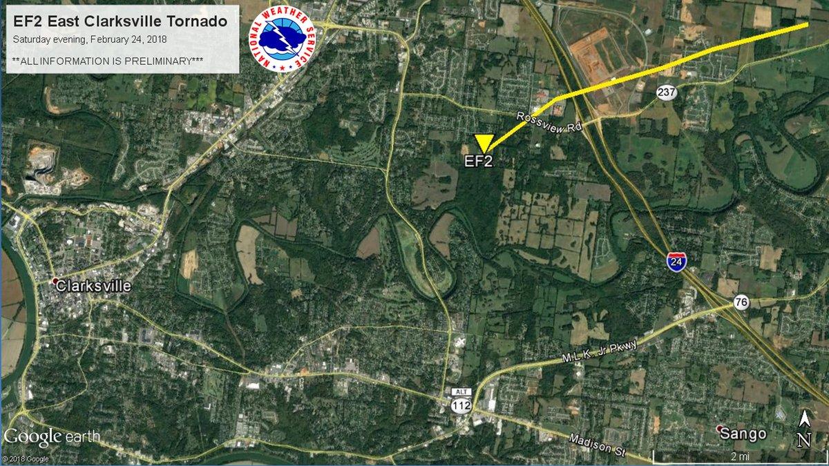 A preliminary assessment of the EF-2 tornado that struck east of Clarksville, Tennessee.
CREDIT NWS NASHVILLE, VIA TWITTER
Monica French of the Kentucky Emergency Management office says there have been three confirmed deaths in west Kentucky: one in Logan County, one in Simpson County and one in Union County.
NWS Paducah says rainfall over the past few days had a total average between 5 to 7 inches in most of the region - higher in some areas. While dry weather has returned, for now, the Ohio River continues to rise. Crews in Paducah have begun installing the floodwall floodgates.
Several roads are closed due to flooding. See the most up-to-date lists on the Kentucky Transportation Cabinet Facebook pages: KYTCDistrict1 an


